I had an idea that was in my mind for quite a time, but since the start of this forum I completely forgot about it, so here it goes.
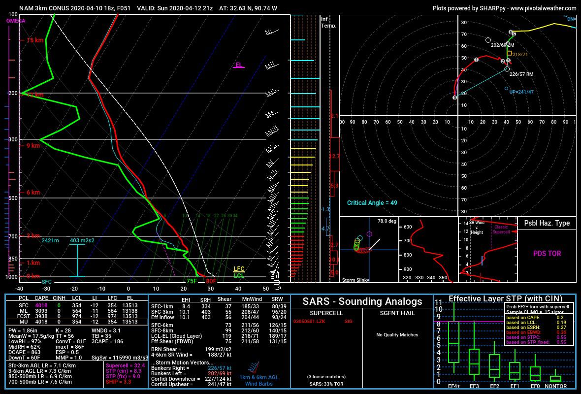
My idea was to create something called "Sounding panel", where you can either see all sounding sites in the US (and maybe globally), and when clicked it opens a window where you can view it (I added an example image from "Pivotal Weather") it can also be used with model data, where you click in the place where you want to see it on the map and it opens up the window where you can see the Skew-T and hodograph. I think it would be a super useful tool for seeing not only the parameters on the 2D raster dataset (for weather models) but also the vertical profile of the atmosphere and I guess there is quite a bunch of people who would love also to see this in one place. 🙂
P.S. Paul, this is a rough start of an idea, I don't have any idea what more information will you potentially need and if this is even possible, but just wanted to share an old idea that would make this product even more powerful. 🙂