The new build is released. Please email me or post here if you run this and everything is green. This is a major update with huge architectural under-the-hood changes. I am releasing this mid-progress on the SDF line style editor - I want to take a focused week on that and without further delaying the next update. So here it is.
1) Massive effort on line SDF styling (50% finished) and new concept of line "StyleMap" presets + common preset selector UI widget now serving raster palette presets and line presets. Note: right now line SDF styling controls are in a transitory state and the controls are overcomplicated and cluttered, but it does work. I can't guarantee your customizations will survive until final styling schemata are in place, but the migrate-on-update system is now newly deployed with this build so that could already work on next update. The line palette editor is also now working.
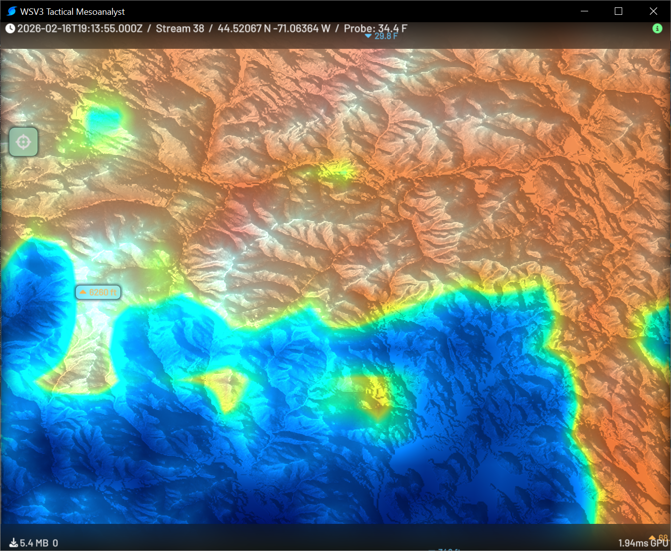
2) Initial implementation of dynamic range color palettes. More info below. This is the initial seed of a novel, meanigful advancement of the state of the art for weather industry geospatial realtime raster dataset rendering.
3) Debut of native Visor engine (on-map native UI cycled by V key and independent of ImGui detailed-UI interface toggled by H) + native Visor.UI layer (will become customizable, scriptable "hit windshield" system for Graphics Studio - currently used for probe tool) + Probe tool with animated time-updating click-drop points and native-rendered SDF text boxes + UI layout system to produce proper alignment of text and glyphs (nice crosshair icon included in probe label)
4) Debut of special "Superblock" 16-bit rendering mode for R2 engine. See below. Previously the note on WSV3.com/Tactical said, "Band 7 streams currently undergo an intentional preprocess temporarily corrupting its display, in preparation for planned special 16-bit raster display ability. Band 7 has special 12-bit resolution whereas 8-bit quantization is applied to other bands at negligible perceptual loss."
5) R2 engine now has smoothing option (bilinear interpolation). This is OFF by default so users can see the raw dataset-native original projection pixels and understand they are getting the real-deal with Tactical Mesoanalyst - original resolution raw data rendered on GPU with no reprojection preprocessing.
6) Major improvement to special seam-free edge reconstruction technique R2 engine uses to render at realtime rates with GPU-compute-driven realtime map projection gbuffer: fixed still-visible seam issue at far-in zooms in point sampling and refactored to support smoothing/bilinear. End result is there are now ZERO visible seams or gaps anywhere. This is a huge win for geospatial visualizaiton as packing neighbor tile texel rows and insetting (the usual, traditional seam avoidance technique for GPU tiled raster) is very expensive on ingest server.
7) Terrain shading (see above)
8) Debut of new "SpatialCache" internal GPU cache datastructure/engine which aims to handle vector tile cache, R1 static terrain texture cache, and R2 timeseries texture cache in one common GPU architecture. Nothing visual perceptible but R1 and R2 engines (terrain and GOES-R data) are now using the new GPU cache code. Test to confirm no regressions.
9) Initial public release of C-transpiled release EXE build. dcc64 (Delphi Pascal compiler) compiled size is 375kb vs msvc C-transpiled public release EXE is now 276kb, without UPX compression. Massive optimization in binary size and also measurable further RAM savings (this build will use overall a bit more RAM since we now have a sidecar texture array cache for the R1 terrain normals for terrain shading).
I will update this post shortly with detailed visual explanation and description of "superblock" 16-bit display of Band 7 data and also of the dynamic range palettes.