MeteoLatvia That is a very surprisingly applicable thing with the windowing settings and the convenient visual indicator you picture for presets. I did envision built-in presets for UI config, but a question remains between saving UI frames state + maps (plural) state together or separately. Either way I love the visual control they have and would be inspired to do something similar in place of the simple combo box (before) or open mapset file dialog (now) that I imagined. I am still deferring many questions like this unto the "settings" stage, which is a late development stage since it depends on the evolution of all the subsystems.
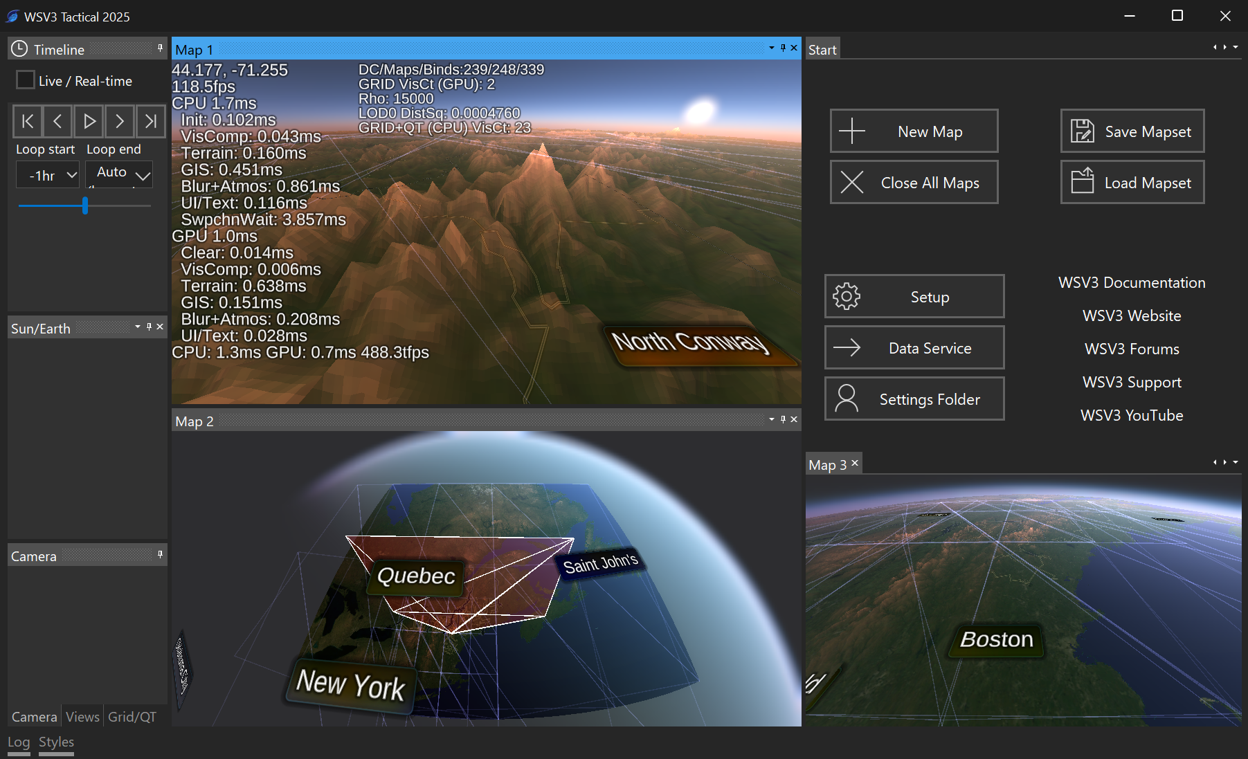
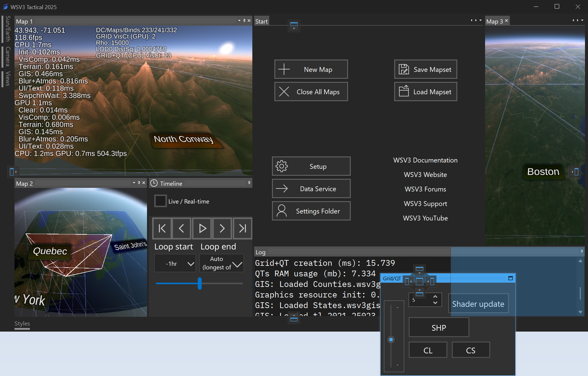
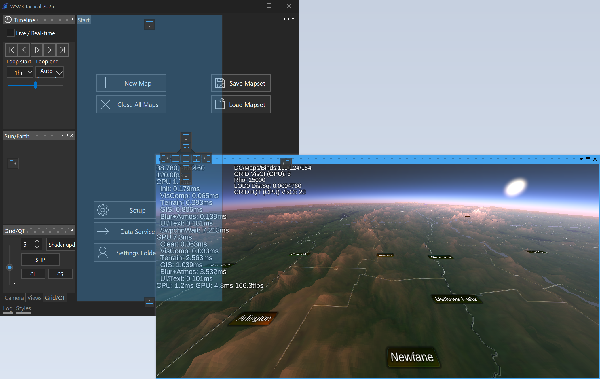
But since the dockable/flexible/rearrangeable UI has become just as much a part of the user config in this new design as the map content states themselves, perhaps there should be one "workset" or "mapset" state which saves/loads all the frames' current content, both UI and map frames, and perhaps there is no single setting/file for a collection of maps without UI/frame state, nor a single setting/file for the UI/frame states without the collection of maps state. This sort of question comes up a lot within the design of a product like this, and I hope you will all comment about what you think to be the most convenient, logical orders. Basically, lots of subsidiary things could be grouped together with likely other things you are changing/saving at once (such as, the "map" concept will save product state, overlays, product settings, camera view, timeline state, atmosphere state, terrain state, GIS style state, etc). In this case, I think having something to save the whole configuration, both maps and UI frames and in their position, is the key element.
Also, I wasn't very clear above, but each individual map will be able to have single, dual, or quad output within itself, and sharing the camera view/mapping, as a special option for supported multi-param raster layers (meso/model , NEXRAD). For that I intended to have a simple three-screen selector between 1, 2, or 4, with similar looking icons to the UI example you posted, but within the eventual selector window specifically for the raster engine settings.
By the way, I haven't announced many big facets of my overall design, and one of them is what you already mentioned about having astronomically accurate solar shading. I envision the atmosphere (or Sun/Earth) state will have graphical controls for visually customizing shading, determining if position is fixed/adjustable or attached to the real-time map timeline time with astronomically correct position calculation. I do also consciously aspire to refactor the new line rendering and eventual terrain rendering engines with separate visual styles for day and night with seamless blending according to sun position. This is all theoretical but within intentions.